Why the two runs don't match
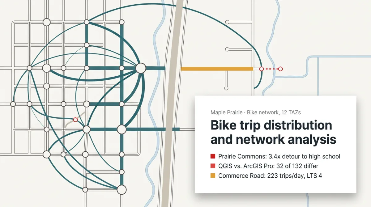
Rerun a trip distribution in another tool and the OD matrix changes. Anyone who's done it knows it's the network: a trail snapped to the street it passes under, a path that never connects, nothing you'd see on the map. The mismatch lands the week the project list is due.
One case on our Try page: a bike trip distribution in QGIS and ArcGIS Pro. Yesper traced every difference to a network error in each tool, fixed both, and the runs agreed. The real gap was a missing link at Prairie Commons: a bike route to the high school 3.4 times the straight-line distance.
The network error turns up before the results go out, and the project that closes the gap is ranked on numbers that hold. Same for the rest of the Try page: a prioritization matrix for intersections, a product review of a road's consultation documents.
Get news and articles in your inbox.
Yesper is the AI civil engineer for construction and infrastructure. AFRY, COWI, NRC Group and other Nordic firms use it to halve the time on a study, rerun calculations in minutes, and catch errors that would otherwise slip through. Get in touch if you'd like to see what it can do for you.
Book demo