Where the point cloud isn't the ground
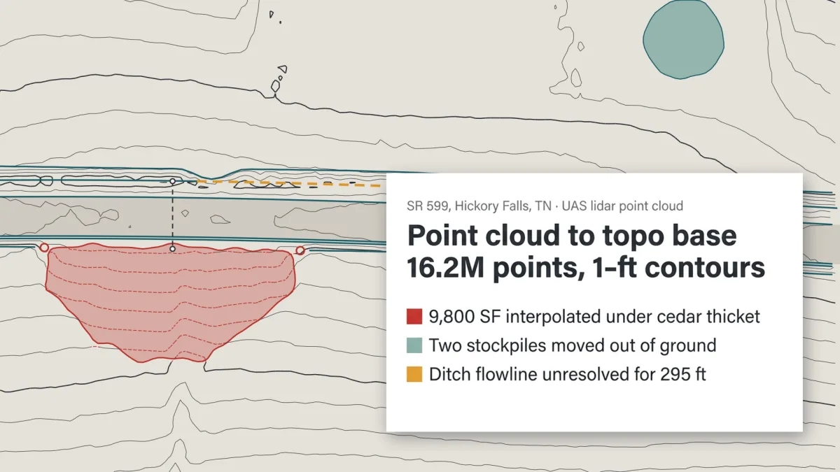
Anyone building a topo base from lidar knows the ground filter is a first pass. Under brush the model fills in what no pulse reached, a stockpile passes as grade, water reads as ditch bottom. You find out once the design is on it.
One case on our Try page: an unclassified UAS lidar cloud. Yesper classified it and delivered the ground TIN, breaklines and contours as DXF and plan sheets, marked preliminary, with the spots not to trust yet: about 9,800 SF interpolated under a thicket at the culvert outlet, and two stockpiles that passed as ground.
The crew goes out with a list, before design starts. The gap shows up in the base map instead of in the cut and fill. Same for the rest of the Try page: soil borings in 3D, quantities from an IFC model, a mass haul for a road job.
Get news and articles in your inbox.
Yesper is the AI civil engineer for construction and infrastructure. AFRY, COWI, NRC Group and other Nordic firms use it to halve the time on a study, rerun calculations in minutes, and catch errors that would otherwise slip through. Get in touch if you'd like to see what it can do for you.
Book demo