Nobody has a model of the surroundings
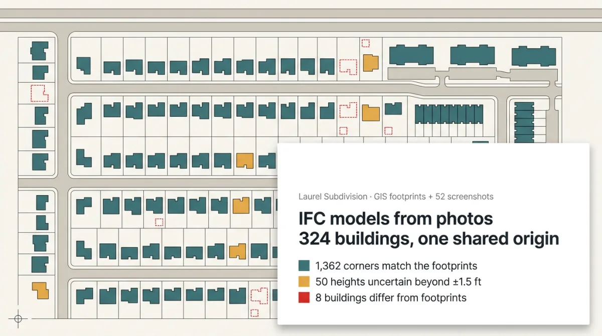
Every shadow study starts the same way. A footprint layer, a site plan in its own coordinates, street-level photos, and someone has to turn that into every building on the block. The heights are the part nobody trusts, and the study won't wait.
One case on our Try page: 324 buildings for a shadow study, from county footprints and street-level screenshots. Yesper handed back georeferenced IFC files on a shared origin, every corner on its footprint, and flagged 50 heights as less certain than the delivery requirements allow.
You know which heights to verify before the study runs. The garage in the footprints but not on the street turns up now instead of at the hearing. Same for the rest of the Try page: an IFC model of catenary masts from a mast list, a topo base from a point cloud.
Get news and articles in your inbox.
Yesper is the AI civil engineer for construction and infrastructure. AFRY, COWI, NRC Group and other Nordic firms use it to halve the time on a study, rerun calculations in minutes, and catch errors that would otherwise slip through. Get in touch if you'd like to see what it can do for you.
Book demo