The typing was never the hard part
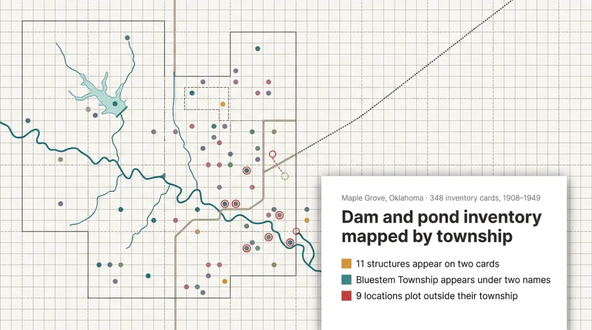
Old inventory cards, scanned once, no text layer. Someone has to type them in, and that's the small part. The same structure under two spellings, a boundary that moved, a digit misread off a pencil note: miss one and the map is quietly wrong for years.
One case on our Try page: 348 scanned cards for dams, ponds and ditches. Yesper read them into a register, a shapefile and a map. 11 structures turned out to be on two cards, one township sat under two names, and the doubtful cards went to a review queue, not the map.
You know on day one which cards need a person's eye. Duplicates and misread digits show up in the register, not on a site visit. Same for lab data from scanned reports, soil borings in 3D, a point cloud to a topo base.
Get news and articles in your inbox.
Yesper is the AI civil engineer for construction and infrastructure. AFRY, COWI, NRC Group and other Nordic firms use it to halve the time on a study, rerun calculations in minutes, and catch errors that would otherwise slip through. Get in touch if you'd like to see what it can do for you.
Book demo