Nobody wrote down the coordinate zone
Anyone who has modelled an existing installation knows this. Most positions are in the design map, the rest in a spreadsheet that never says which zone it's in. Nothing says which way they face. Stitching it together comes first. Everything else waits.
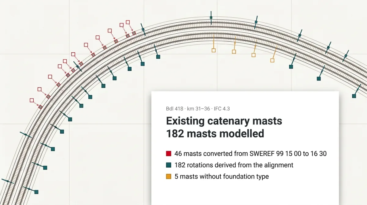
One case on our Try page: an IFC model of existing catenary masts. Read as given, 46 masts from the mast list stood 82.9 km east of the track: wrong coordinate zone. Yesper converted them, turned each to follow the track and flagged those without a foundation type to verify on site.
The zone error surfaces in the build instead of at the coordination review, and the site visit has its list. Same for the rest of the Try page: a coordinate check on catenary foundations, handholes from a schedule into the model, a topo base from a point cloud.
Get news and articles in your inbox.
Yesper is the AI civil engineer for construction and infrastructure. AFRY, COWI, NRC Group and other Nordic firms use it to halve the time on a study, rerun calculations in minutes, and catch errors that would otherwise slip through. Get in touch if you'd like to see what it can do for you.
Book demo